Planning your first Lake Powell vacation can be exciting, but with so many incredible places to see and things to do, it can also feel a little overwhelming. Should you spend more time on the water? Is Horseshoe Bend worth the stop? Which slot canyon should you visit? And how do you fit everything into just a few days?
The good news is that with a little planning, you can experience some of the very best that Page, AZ and the surrounding area have to offer in just three days.
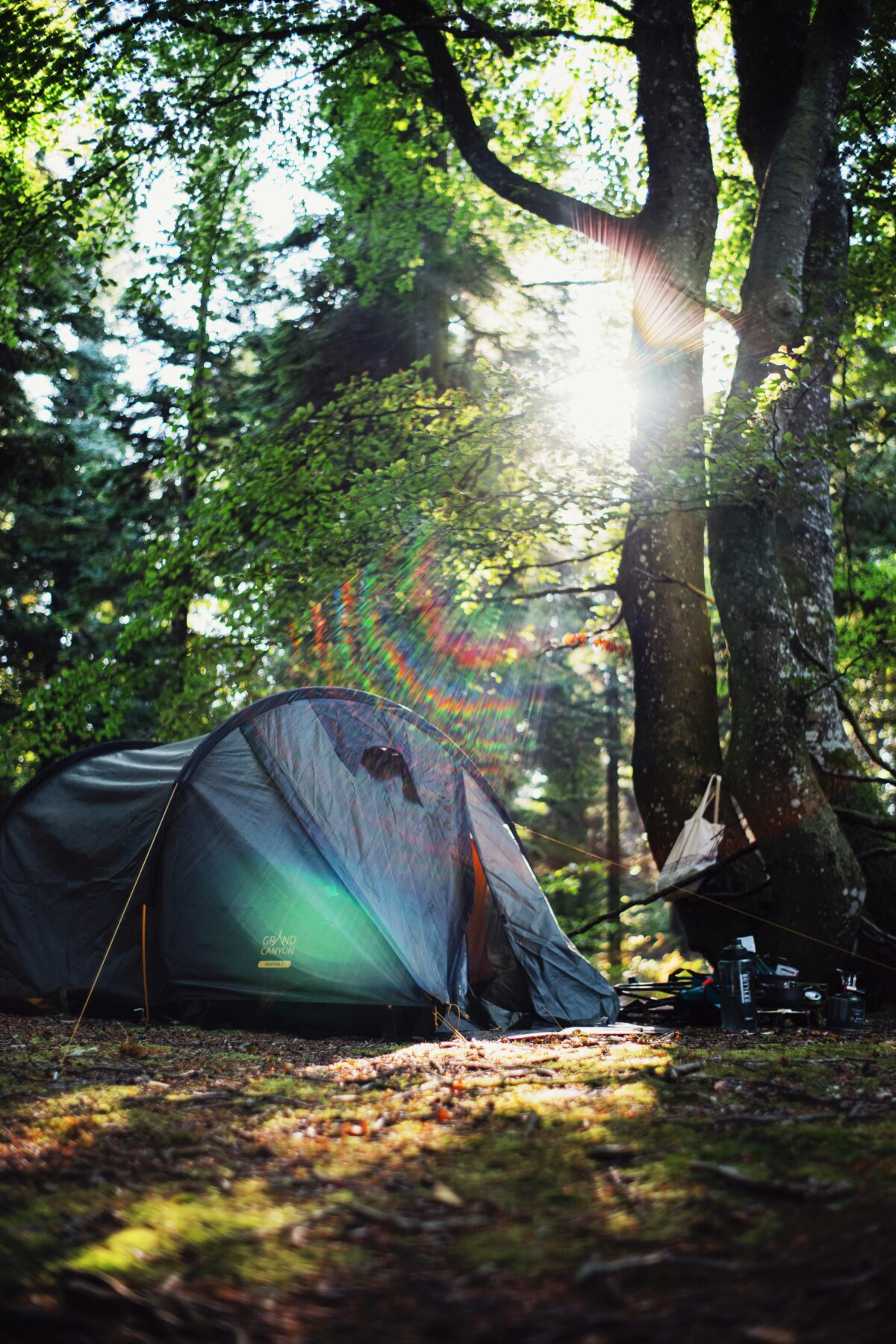
Lake Powell is unlike anywhere else in the country. With more than 1,900 miles of shoreline, towering sandstone cliffs, hidden coves, crystal-clear water, and easy access to world-famous attractions, it’s a destination that combines outdoor adventure with unforgettable scenery. Whether you’re traveling with family, planning a couples getaway, bringing your RV, or crossing the Southwest off your bucket list, a well-planned itinerary will help you make the most of your visit.
As local guides, we’ve spent countless days exploring Lake Powell. We’ve learned that the best trips balance iconic attractions with time to simply enjoy the lake. This itinerary is designed to help first-time visitors experience both.
If you’re looking for even more recommendations after reading this guide, be sure to check out our Things to Do in Page, AZ page, where we share many of our favorite attractions, local businesses, restaurants, and hidden gems.
Day 1: Experience the Best of Page, Arizona
Your first day is all about seeing the landmarks that have made Page, Arizona one of the most popular destinations in the Southwest.
Start Your Morning at Horseshoe Bend
There’s a good chance you’ve already seen photos of Horseshoe Bend, even if you didn’t realize it. This famous overlook features a dramatic curve in the Colorado River surrounded by towering sandstone cliffs, and it’s one of the most photographed locations in Arizona.
The trail to the overlook is relatively short, making it an easy stop before the temperatures climb later in the day. If you’re visiting during the warmer months, try to arrive early in the morning. Not only will you enjoy cooler weather, but you’ll also have a better chance of avoiding the largest crowds.
Standing at the overlook gives you an appreciation for just how massive the Colorado Plateau is. It’s a great way to begin your trip and provides an incredible introduction to the landscape that surrounds Lake Powell.
Explore a Navajo Slot Canyon
No first visit to Page is complete without walking through one of the area’s incredible Navajo-owned slot canyons.
While Antelope Canyon is the most well-known, it’s certainly not your only option. Several beautiful Navajo slot canyon tours offer stunning sandstone formations, winding passageways, and incredible opportunities for photography.
Each canyon has its own personality, but they all share the same breathtaking features. Over thousands of years, flash floods carved smooth walls, twisting corridors, and flowing rock formations that seem almost unreal when sunlight filters down from above.
If you’re deciding between tours, don’t stress too much about finding the “perfect” canyon. Any professionally guided slot canyon experience is well worth your time and offers a chance to learn about the area’s geology and Navajo culture while exploring one of nature’s most unique landscapes.
Enjoy Lunch in Downtown Page
After your morning adventures, head back into Page, AZ for lunch.
One of our favorite recommendations is BirdHouse, a local favorite known for its fresh ingredients, flavorful chicken, and relaxed atmosphere. If you’re in the mood for Mexican food, El Tapatio has been serving visitors and locals for years and is another excellent option.
One of the things we enjoy about Page is that while it’s a small town, it offers plenty of great places to eat after a morning spent exploring.
Spend the Afternoon at Glen Canyon Dam
Many visitors drive past Glen Canyon Dam without realizing how important it is to the entire region.
The dam created Lake Powell and continues to play a major role in water storage, hydroelectric power, and recreation throughout the Southwest. Even if engineering isn’t normally your thing, it’s worth taking a little time to stop at one of the overlooks or visit the Carl Hayden Visitor Center to appreciate both the history and the incredible views.
Looking out over the Colorado River below the dam gives you a completely different perspective than you’ll see from the lake itself.
If you’re interested in learning more, we’ve put together a detailed guide covering the history, purpose, and fascinating facts about Lake Powell & Glen Canyon Dam.
End Your Day with Dinner
After a full day of sightseeing, you’ve probably worked up an appetite.
If you’re craving barbecue, Big John’s Texas BBQ is a local favorite known for smoked meats, generous portions, and a fun outdoor atmosphere. During the warmer months, you’ll often find live music, making it a great place to relax after a busy day.
If you’re looking for a more traditional sit-down restaurant, Bonkers Restaurant offers a varied menu that includes steaks, seafood, pasta, and American favorites.
No matter where you choose, taking time to enjoy the local restaurants is part of the experience. Tomorrow, your adventure shifts from sightseeing to what many visitors consider the highlight of their trip: spending a day on Lake Powell itself.
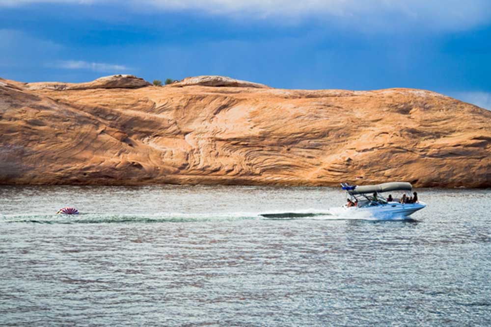
Day 2: Get Out on Lake Powell
You simply can’t visit Lake Powell without spending time on the water.
While the overlooks and hiking trails provide incredible views, they only tell part of the story. The real magic of Lake Powell happens once you leave the shoreline behind and begin exploring the winding sandstone canyons, towering cliffs, and hidden coves that make this place unlike anywhere else in the country.
There are several ways to experience the lake. Some visitors rent boats, others bring their own watercraft, and many enjoy kayaking or paddleboarding in the quieter sections of the lake.
But if you’re hoping to experience Lake Powell like a local, there’s one option we recommend above the rest.
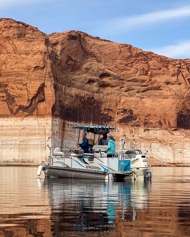
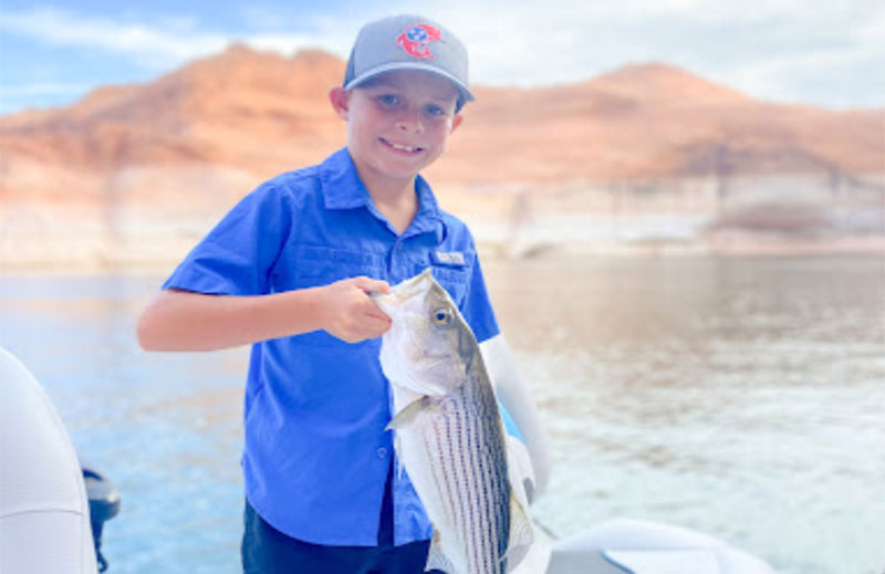
Book a Guided Lake Powell Fishing Trip
Whether you’ve been fishing your whole life or you’re trying it for the very first time, a guided fishing trip is one of the best ways to experience Lake Powell.
Instead of spending your vacation trying to figure out where the fish are biting or learning your way around the lake, you can spend your time enjoying the experience while someone who knows these waters handles the details.
At Lake Powell Guide Services, we spend countless hours on the lake throughout the year. We stay on top of changing water conditions, seasonal fish movements, and the techniques that are producing the best results. That local knowledge helps put our guests in the best position for a successful and enjoyable day on the water.
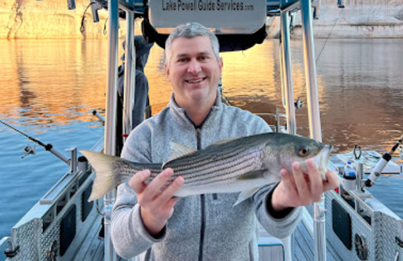
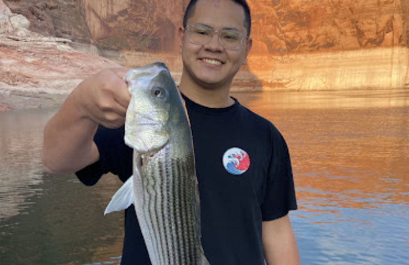
Lake Powell is home to several popular sport fish, including striped bass, largemouth bass, smallmouth bass, crappie, bluegill, and walleye. Every season offers something a little different, which is one of the reasons so many anglers return year after year.
But even if fishing isn’t your primary goal, spending a morning surrounded by towering red rock cliffs, calm blue water, and incredible scenery is an experience that’s hard to match.
During a guided trip, you’ll often see parts of the lake that many visitors never reach. Quiet coves, dramatic canyon walls, and wide-open stretches of water create a completely different perspective than what you see from the highway or the overlooks around Page, Arizona.
For many guests, the combination of Lake Powell fishing and sightseeing ends up being the highlight of the entire vacation.
Afternoon: Relax, Swim, or Explore More of the Lake
After a morning of fishing, spend the afternoon enjoying the lake at a slower pace.
Some great options include:
- Swimming at one of the sandy shoreline areas
- Taking a scenic boat ride through nearby canyons
- Relaxing at the marina
- Enjoying sunset views over the water
If you’re traveling with kids, this is often the perfect time to let everyone unwind after a busy first day of sightseeing.
Dinner: A Local Favorite Near the Lake
For dinner, consider heading to The Barn Yard. It’s a relaxed, family-friendly spot that’s become a favorite recommendation for visitors looking for good food and a more local atmosphere.
After a full day on the water, a hearty meal and a slower evening are usually exactly what people need before one more day of exploring.
Day 3: Hidden Gems & Scenic Exploration
Your final day is a chance to slow down a little and experience some of the places that don’t always make the top of the tourist lists.
Morning: Scenic Views Around Glen Canyon
Start the morning by exploring some of the scenic overlooks around Glen Canyon National Recreation Area. Early morning light on the red rock cliffs can be spectacular, especially for photography.
This is also a great time to revisit any spot you felt rushed through earlier in the trip.
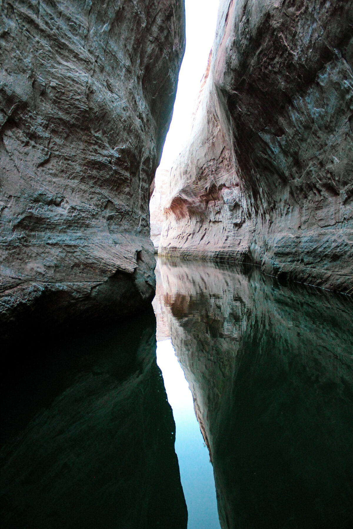
Midday: A Scenic Water-Based Canyon Tour
If you enjoyed being on the lake during your fishing trip, consider spending part of the day on a water-based canyon tour.
Unlike hiking-based experiences, these tours allow you to access narrow canyons and remote sections of Lake Powell that are only reachable by boat. The reflections, sandstone formations, and quiet water make it a favorite experience for photographers and visitors looking for something a little different.
It’s also an excellent option for travelers who want the beauty of the canyons without a long hike.
Afternoon: Shop, Relax, or Revisit Your Favorite Spot
By this point, you’ve probably discovered a few places you’d like to spend more time. Use the afternoon to:
- Pick up souvenirs in Page, AZ
- Enjoy a leisurely lunch
- Return to a favorite overlook
- Relax before your drive home
Tips for First-Time Visitors to Lake Powell
Give Yourself More Than One Day
Many people underestimate how much there is to do here. A three-day trip is a great starting point and gives you time to enjoy both the famous attractions and the lake itself.
Book Popular Tours Early
Slot canyon tours, guided fishing trips, and lake activities can fill up quickly during spring, summer, and fall.
Bring Plenty of Water
The desert climate around Page, Arizona can be much hotter and drier than visitors expect.
Plan for Both Land and Water Activities
The best Lake Powell vacations usually include a mix of hiking, sightseeing, and time on the water.
Why Lake Powell Is Worth the Trip
What makes Lake Powell special isn’t just one attraction. It’s the combination of everything in one place: world-famous landmarks like Horseshoe Bend, incredible Navajo slot canyons, boating, fishing, photography, camping, and some of the most dramatic scenery in the Southwest.
For first-time visitors, this three-day itinerary of a Lake Powell vacation offers a great balance of the highlights while still leaving room to relax and enjoy the lake.
And if you’re looking for even more ideas, local recommendations, restaurants, lodging, and activities, be sure to explore our Things to Do in Page, AZ guide before your trip.
We’d also love to help you experience the lake from the water. Whether you’re interested in Lake Powell fishing, a scenic photography tour, or simply seeing more of the canyons than most visitors ever do, Lake Powell Guide Services is here to help make your trip unforgettable.